
Between 1981 and 2004 Exeter Civic Society published a series of booklets about the city. Most of them are still available. Out of print booklets have been scanned and are available for members of ECS. Please contact us under exetercivicsociety@gmail.com if interested. In Nov 2024 we started the publication of the 2nd edition of the booklets which are out of print, with ‘St Leonard’s and the Quay’ being the first one on offer. These booklets are updated and revised, so contain a lot of additional information in a new layout. In Feb 2026 a new booklet was added as No 13, covering ‘Countess Wear’. You can purchase copies of the booklets in print from our merchandise page: https://webcollect.org.uk/exetercivicsoc/event/merchandise, or for the 2nd edition: https://webcollect.org.uk/exetercivicsoc/event/discovering-exeter-second-editions.
The complete list of booklets:
- St David's - out of print: you can become a member and download a pdf copy from the membership section
- St Leonard's and the Quay. 2nd edition, revised and updated by Ian Maxted, Nov 2024
- Heavitree - out of print: you can become a member and download a pdf copy from the membership section
- Pennsylvania - out of print: you can become a member and download a pdf copy from the membership section
- Sidwell Street and St. James. 2nd edition, revised and updated by Julia Neville, Oct 2026
- West of the River
- Lost Churches
- Gates of the Close
- Community Mosaics
- Public Inscriptions
- 20th Century Architecture
- Street Names
- Countess Wear, newly published in Feb 2026
1st volume of the revised edition published from Nov 2024 onwards now available

NEW GUIDE TO ST LEONARD’S AND THE QUAY
Exeter Civic Society has published a revised edition of its definitive historical and architectural guide to St Leonard’s and the Quay. It is the first revision in over 40 years and is part of a programme to update all the guides to the areas outside the city centre in the Discovering Exeter series. The next ones will cover the Sidwell Street area and St Thomas’ and Exwick in West of the River.
Although much of the original guide has stood the test of time, there is a great deal that is new – even some ‘new’ history. Recent archaeology has revealed a mediaeval graveyard around the site of the St Mary Magdalene hospital for lepers near Bull Meadow. And close inspection of Braun and Hogenburg’s map of 1618 suggests that the beam of the gallows which stood on the corner of what is now St Luke’s carpark went right across the road. A grisly experience for anybody travelling along Magdalen Road. The last public hanging there was in 1819.
The guide also reveals quirky new facts. Who knew, for example, that there was a skating rink on the site of 93 Magdalen Road from 1876 to 1877, one of three in Exeter, when the craze for roller skating swept across Britain from America. Or that the Rupert Annual was published from the Old Rectory on Matford Lane between 1993 and 2004.
But the biggest changes have of course been in the built environment, with both small and large developments. For example, The Deaf Academy on Topsham Road which stood there since 1828 has been demolished and replaced by the ‘St Leonard’s Quarter’ residential accommodation. The Wellingtonia Park estate has appeared on land once owned by James Veitch, although his house and a giant Wellingtonia still stand.
The Quay has also been a part of that. Although, rightly, the buildings have not changed substantially, it has been greatly reinvigorated and refurbished since the original guide was published in 1982 and is now a major attraction to Exeter residents and tourists alike – probably not something the original author imagined could happen.
Change will continue. St Luke’s had playing fields in 1982. They are now a car park which may soon be developed as part of a health science centre. Part of the grounds of County Hall may be sold off for development. But the guide captures a point when St Leonard’s can still claim to be ‘flowery and bowery’ as the novelist George Gissing who lived there from 1891 to 1893 described it.
The guide has two guided walks around the area, picking out all the interesting features. It costs £5 and is available via Exeter Civic Society’s website.
New in 2026
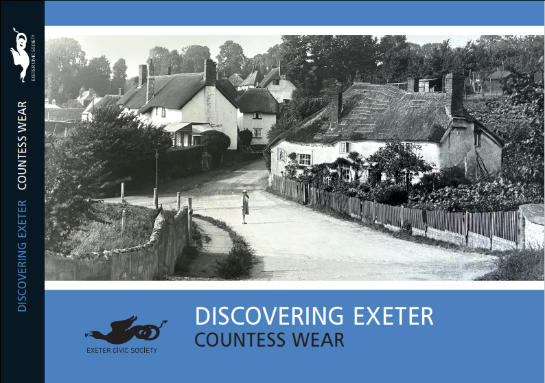
NEW GUIDE TO COUNTESS WEAR
Vol 13 is an addition to the original series rather than a revision, and has been written by the Countess Wear Heritage Group. We are very grateful to our member Angela Goddard and her colleague Laurie Fentiman for writing the book.
Countess Wear today is a suburb of Exeter midway between the city centre and Topsham. Many people will know it only as a section of the Topsham Road, the road along which so many goods were brought by horsepower up from the port at Topsham to the city, originally called the Portwey. The road’s importance to the Romans was shown by the excavation of a substantial industrial and commercial Roman site at what is now Millbrook Retirement Village.
The settlement that became known as Countess Wear lay to the south of the main road, running down to the banks of the Exe. Its name derives from the Countess Isabella de Fortibus, whose estates included both Countess Wear and Topsham. In the 13th century she ordered the construction of a weir at this point to power her watermills. The effect of this was to restrict larger ships from travelling up to Exeter Quay. They had to unload their goods at Topsham and bring them up the road instead.
For many centuries Countess Wear consisted of two settlements: Higher Wear, around Mill Lane and Lime Kiln Road, and Lower Wear, on Glasshouse Lane. They were ringed by farms, market gardens and the country house estates such as Wear Barton and Northbrook Lodge. The area, originally part of Topsham, became a parish in its own right in 1844 and was absorbed into Exeter in 1939.
The proximity of the river as a source of water and power also led to the establishment of local industries such as glassmaking and papermaking. What had once been corn mills were converted to serve the growing demand for such products. A range of kilns for burning lime was also constructed at Lower Wear.
In the 1770s the first bridge across the Exe at Countess Wear was built by the Exeter Turnpike Trust. The charge for crossing it was on a sliding scale from one penny per person to one shilling for a coach and six horses. With the development of motor traffic the bridge was widened in 1938 as part of the Exeter by-pass, and more recently, in 2017 by the addition of a cantilevered extension.
The guide provides more detail about the history of the buildings, the residents and significant events in the area’s history and describes a five mile walk around the points of interest. It costs £5 and is available via the Exeter Civic Society website.
New in October 2026
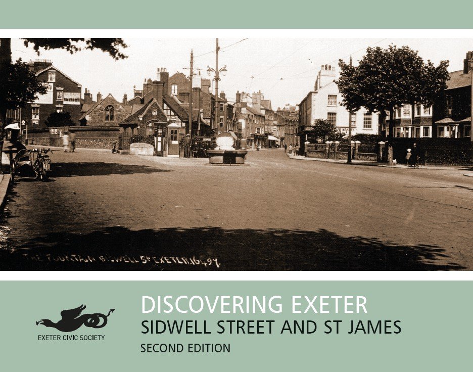
Revised and updated Guide on Sidwell Street St James
Discovering Exeter: Sidwell Street and St James
The original booklet no. 5 in the Discovering Exeter series, Discovering Exeter: Sidwell Street has now been revised and updated by Julia Neville and re-named Discovering Exeter: Sidwell Street and St James to include more explicitly the area covered to the north of Sidwell Street.
Sidwell Street itself begins where the two roads from the north-east, one from Stoke Hill and the other from Pinhoe, merge in a single road leading to the former East Gate of the city. When the Romans occupied and fortified Isca Dumnoniorum they built shrines along Sidwell Street and, only discovered in 2019, a Roman fortlet south of the street.
This area and the slope north of it to the Longbrook valley hold a number of springs of water that bubble up through the sandstone. Water from these springs was used not only by those living immediately around them, but was also, at least from the Middle Ages, piped along aqueducts into the walled city. One of the springs became associated with Exeter’s own saint, St Sidwell. St Sidwell was believed to have been an early Christian martyr beheaded by haymakers, and, at the spot where her head is supposed to have fallen, a well over one of these springs was named St Sidwell’s well. A church was built nearby and dedicated to her and became a place of pilgrimage.
In the Middle Ages St Sidwell’s parish was independent of the city of Exeter. Though the land was vested in the Dean and Chapter of the cathedral, St Sidwell’s had its own mayor, guildhall and market. In the sixteenth century it was officially incorporated into the city and has remained so ever since. Buildings, many of them low thatched cottages where the weavers lived and worked, lined the main road as far as the Fountain where Old Tiverton Road and the Blackboy Road met, but behind these cottages were fields and market gardens.
During the Civil War the Royalists, who had gained control of the city in 1642, razed to the ground every building along Sidwell Street to deprive their opponents of for cover. After the city was surrendered to the Parliamentarians in 1646 a complete rebuilding was necessary. Gradually the built-up area stretched up the Blackboy and Old Tiverton Roads, where large and elegant houses survive. Then, particularly after the railway arrived, the slopes on both sides of the Longbrook valley were filled in with Victorian terraced housing and the amenities to meet the needs of their tenants – a new church, new schools, a public park, pubs, sports grounds and a tramway.
Photographs of the time show Sidwell Street as a busy shopping area with well-known names above the shop fronts like the Home and Colonial Stores, Charles Panter the draper and Holman Ham the chemist. In between the shops were entrances to the little courts where poorer families lived in tiny cottages jam-packed together. This overcrowding meant that when bombs fell during the Blitz on the lath and plaster of the houses fire swiftly took hold and much of the western end of Sidwell Street burnt to the ground.
Again, the street was rebuilt. 1960s’ shops, including a seven-storey skyscraper occupied by Bobby’s department store, replaced those from the earlier era. More recently rising numbers of students in Exeter have led to a demand for extra accommodation and the redevelopment of some sites and existing properties to meet that need. The old bus station site has been partially redeveloped with a new smaller bus station and St Sidwell’s Point leisure centre, Now (2026) plans for the redevelopment of the remainder of the Paris Street and Sidwell Street are under active consideration.
The book suggests three walks to explore the area which can be undertaken separately or as a complete circuit.
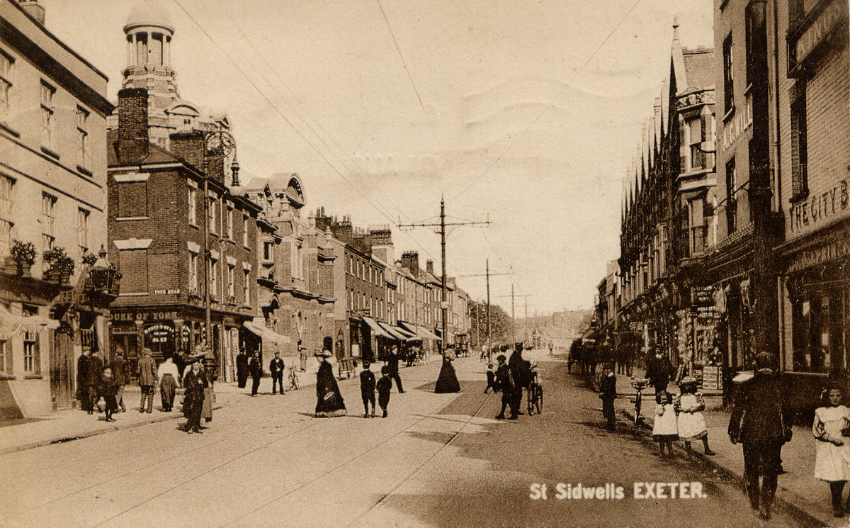
A spare picture of Sidwell Street.
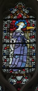
St Sidwell in Exeter Cathedral’s east window, credit WmFinnigan.